Tour name: Harz Witches’ Trail
Degree of difficulty: Valley trails
Tour length: 100km
Total elevation: 900m ascent and 940m descent
Alignment: East
Highest point: Brocken (1141m)
GPS: route and track as GPX
In the center of Germany there lies one of the most beautiful hiking trails of the country: The Harz Witches’ Trail.
With a total distance of 150km, the long-distance trail leads from Osterode to Thale. It combines magical places with largely untouched nature and insights of the history of the Harz mining industry.
Nature, culture, and history – the Harz Witches’ Trail has so much to offer!
In addition, the route is highly flexible: The five stages are partially provided with alternative sections. An entry to the Witches’ Trail is possible in many places. Even from the end of the route – that is, from east to west – is no problem. On the way the trail regularly passes smaller villages, so that opens up to individual needs, a variety of accommodation.
Also, friends of the Harzer hiking nobility can also look forward to a total of 20 stamps along the way..


Stage 1
Osterode to Buntenbock (11 km)
From the half-timbered town of Osterode, the Harz Witches’ Trail starts. The route leads over the Clausthaler plateau to Buntenbock, a southern suburb of Clausthal-Zellerfeld. The slightly ascending route runs along the historic trade route Hundscher Weg, where food and iron ore were transported from Osterode to Clausthal.
Particularly worth seeing is the Marienblick, from where you have a magnificent view of the Lerbachtal.
In Buntenbock, as well as in Clausthal-Zellerfeld, a few kilometers north, there are accommodations, apartments, and hotels.

Stage 2
Buntenbock to Torfhaus (22km)
The second stage of the Witches’ trail surprises with a multitude of man-made trenches, ponds, and lakes. The roots of the so-called “Upper Harz water management” are in the 13th century, a time in which the mining had to be constantly supplied with water. The created water supply and storage system is one of the UNESCO World Heritage Sites!
On the way, the witch’s trail passes the town of Altenau. For everyone who wants to shorten the stage, here has the opportunity to spend the night. Behind Altenau the Harz National Park begins with untouched nature, which also houses the shy lynx among other animals.
The slope continues to increase until the settlement Torfhaus is reached.

Stage 3
Torfhaus to Drei Annen Hohne (20km)
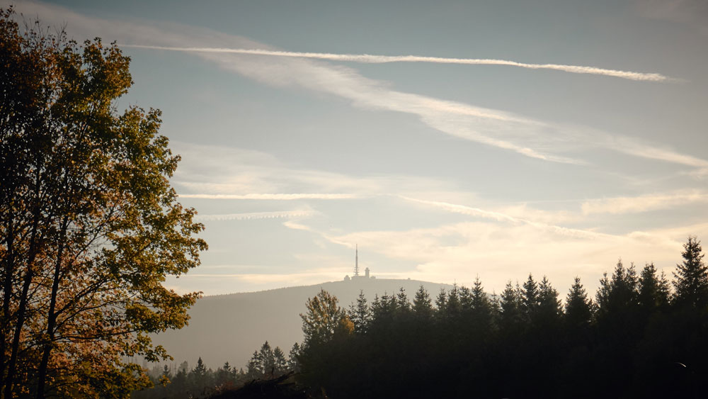
Along the Goetheweg the witches’ trail runs past bogs over the former inner German border up to the Brocken. The highest mountain in northern Germany attracts especially in fine weather for a magnificent view of the surrounding Harz.
Alternative route
Torfhaus to Königshütte (36km)
Those who already know the Brocken or want to avoid the ascent for other reasons can use a bypass. This leads from the Torfhaus from the south over Sankt Andreasberg, Braunlage and Elend to rejoin the main route just before Königshütte.
Stage 4
Three Annen Hohne to Altenbrak (30km)
northern option:
We continue past the Rübeland, a district of Elbingerodes. Here mining is still active today. From the lookout point “Hoher Kleef” you can see how lime is mined. In Rübeland are also the two known caves Herrmann’s- and Baumannshöhle. In addition, the path leads along the imposing Rappbode dam, the largest drinking water dam in Germany.
southern option:
Alternatively, you can go to Königshütte the Rappbode dam and make a turn south. The route is thus much flatter than the northern option with its climbs. About Hasselfelde the path runs along the Köhler path to Altenbrak. Insights into the history of the region are revealed by information boards and the Schauköhlerei am Stemberghaus.
Stage 5
Altenbrak to Thale
On the last stage of the Witches’ Trail, the tour continues through the Bodetal between Treseburg and Thale. Through the gorge, which is also affectionately referred to as the “Grand Canyon of the Harz”, the path runs along massive stone walls. The Bode flows right next to the path and sprays moisture that pebbles on the granite.
Finally, in Thale the stairway ends at the Hexentanzplatz (literally “Witches′ Dance Floor”) – how could it be otherwise?
Tip: From time to time the trail is partly restricted because of work or weather-related reasons. Current information can be found here

