Tour name: Mulde
Degree of difficulty: easy
Tour length: 135 km
Alignment: North-West
GPS: route and track as GPX
The Mulde is not nearly as well known as the Elbe, Danube, Isar, and co. – How comes? We were on the road on one of the underestimated rivers of Germany: The Mulde. In total, there are five different Mulde rivers (Red Mulde, White Mulde, Zwickauer Mulde, Freiberger Mulde, United Mulde).
The Red and the White Mulde spring in the Vogtland, in the south of Saxony. At the near the city of Schöneck, they flow together and form the so-called Zwickauer Mulde. This meanders further north and passes through the cities of Zwickau and Glauchau.
The Freiberger Mulde has its origin near the German-Czech border. From there it flows via Freiberg, Nossen, Döbeln, and Leisnig to Colditz. Here she connects with the Zwickauer Mulde – together they become the United Mulde. This leads the water further north across Saxony to the Saxon-Anhalt border, until it finally flows into the Elbe.
On the way with the kayak
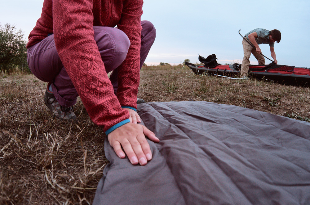
Freiberger Mulde, Zwickauer Mulde, and the United Mulde are accessible by kayak or canoe. In several excursions, we paddled the Freiberger and the Vereinigte Mulde (as far as it was allowed). Particularly characteristic of both sections is their naturalness: as far as possible, the river snakes through the landscape. In places, it is thus quite flat so you can hear the gritty river bed singing in the current.
The paddling itself is very pleasant. With a flow speed of about 2-3 m per second, the landscape moves comfortably past. So there is enough time to watch – and you can get along without noticeable paddling. But be careful regarding the stones and trees protruding from the water – otherwise, it is recommended to enjoy the largely untouched nature and to look for animals!
Our tour:
Stage 1: Between monasteries and castles
- from Kloster Buch to Grimma (26 km)
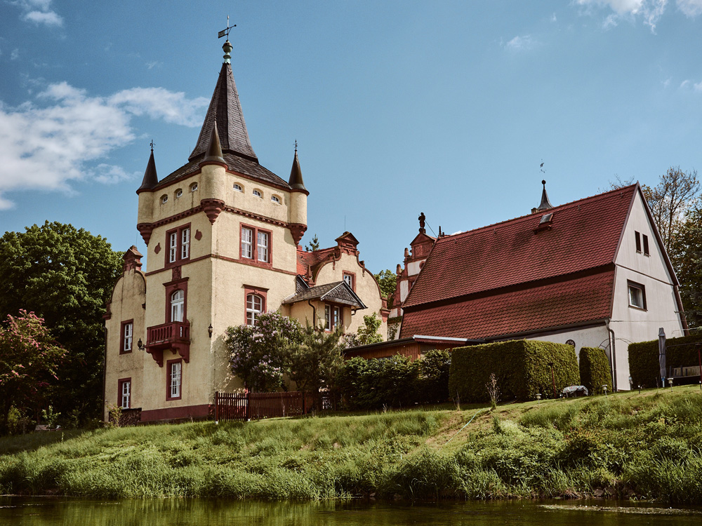
From the historic Kloster Buch, the journey begins on the Freiberger Mulde. Along this section, you can admire the relics of yesteryear. These include the castle Mildenstein and the moated castle Podelwitz. After a few kilometers, you reach the spot where the Zwickauer Mulde and Freiberger Mulde merge to form the United Mulde. On this, it goes further north, past the Kötteritzscher castle, the castle ruin Nimbschen and the ship mill Höfgen.
Note: In this section, there are two weirs, you can’t pass on the water (weir Leisnig-Festwiese and weir Leisnig-Fischendorf). Detailed information is available here.
Stage 2: Weirs, weirs over weirs
- from Grimma to Wurzen (20 km)
The section between Grimma and Wurzen has one thing above all else: Weirs! A total of five this means: get off, carry around, get in … a stage with a sporty touch.
More detailed information about the weirs and the places to get in and out of the water you can read in the GPS data.
Stage 3: For nature lovers and gourmets
- from Wurzen to Eilenburg (20 km)
After the hardships of the previous stage, the diligent paddler will be rewarded. Stage 3 is probably the most beautiful stretch of road to here: the course of the river is very natural and strongly curved. The surrounding landscape is untouched as it is a flood protection area. The small islands in the water finally make the idyll perfect.
Tip: We highly recommend it in front of Eilenburg turn left into the mill ditch. On this, you can paddle through Eilenburg. After all the green, a welcome change … along the river, there are also restaurants with a private dock for paddlers.
Keep in mind: the closest pier after Eilenburg is the passenger ferry in Gruna about 15km away. Entering the shore is not allowed before, as it is a nature reserve.

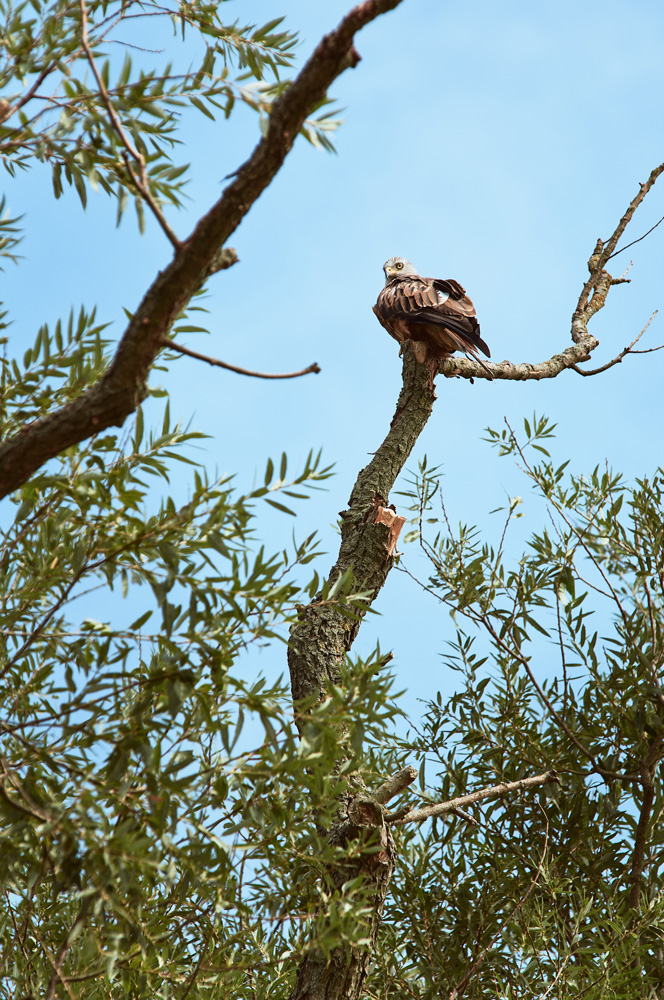
Stage 4: On safari
- from Eilenburg to Bad Düben (28 km)
The passing of this section is only possible from 15.7. until 31.10., while landing or entering the bank between both places is, as already mentioned, only allowed at the passenger ferry in Gruna. The nature reserve thanks to the law-abiding paddlers with an incredibly diverse wildlife. In the water, on land and on the natural river islands, beaver, otter and countless bird species have settled.

Stage 5: Border passage
- from Bad Düben to Schlaitz (20 km)
After the previous 4 stages passed through Saxony, the state border with Saxony-Anhalt has now been reached. After Bad Düben river banks are increasingly straightened before the river flows into the Muldestausee.


Stage 6: The End
- from Schlaitz to Raguhn (ca. 21 km)
This last section of the United Mulde is only passable on the last Sunday in September.
Link to Description of the Mulde (in German)
Link to German Canoe Association (in German)
